Once a storm becomes a tropical cyclone, destruction – including flooding – follows in its wake. After Cyclone Idai caused severe flooding in Malawi’s coastal regions in 2019, the Malawian government asked SERVIR (a partnership between NASA and USAID) to join its flood mitigation efforts. Together, they developed a community-based flood early warning system (CBFEWS). When cyclones struck again in 2022, this tool helped spare lives and saved Malawi an estimated $40 million in losses compared to previous cyclone seasons. Now, the government of Malawi, SERVIR, and other critical partners are planning to build on these successes and upscale the community-based flood early warning systems to 10 southern districts frequently affected by cyclones.
SERVIR collaborates with geospatial organizations in Asia, Africa, and Latin America to help communities address environmental challenges using data from Earth-observing satellites. Services generated from this partnership support communities by providing information that enables improved decision-making to strengthen food security, water resource management, and disaster risk reduction.
To develop this CBFEWS, SERVIR scientists at the Kenya-based Regional Centre for Mapping of Resources for Development (RCMRD) led an initiative to replicate the flood early warning service developed for Asia’s Hindu Kush Himalaya region by SERVIR scientists and the International Centre for Integrated Mountain Development (ICIMOD) to work in the flood-prone districts of Malawi. By the time Cyclones Gombe and Ana hit in early 2022, the CBFEWS was up and running and providing an operational 15-day forecast, thanks in large part to the efforts of Brigham Young University’s Jim Nelson and the Group on Earth Observations for Global Water Security’s European Centre for Medium-Range Weather Forecasts Streamflow Model.
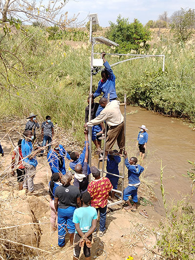
This CBFEWS enables a significant extension of forecast lead times from hours to days, which gives people and communities the time needed to prepare and take action before a predicted flood. Samuel Gama, the principal mitigation officer at Malawi’s Department of Disaster Management Affairs, noted, “With that type of warning being generated from the instruments that we have installed through technical support from RCMRD, we have been able to at least spare some lives that would have been affected by such disasters.”
This CBFEWS program initially started by projecting flood risk using data from ground-based sensors. SERVIR partners around the world helped expand the program's capabilities with the inclusion of satellite data, allowing early warning systems to alert communities even earlier. Key players included the United Nations Development Programme, the International Centre for Integrated Mountain Development (ICIMOD), the RCMRD, and the Malawi Red Cross Society. SERVIR’s structure aids this level of international collaboration by connecting stakeholders with open science and a global network of expertise.
Following these successes, the World Bank is aiding the effort to expand the program by providing significant funding. These funds, along with those already provided by the Green Climate Fund through the United Nations Development Programme (UNDP), will be used to implement the community-based flood early warning systems in other districts where floods pose a significant threat. Nelson will also continue to collaborate with RCMRD and other partners to extend Group on Earth Observations for Global Water Security streamflow services in Eastern and Southern Africa as part of the SERVIR Applied Sciences Team. As Gama noted, “The advantage that we have appreciated from these instruments is beyond what our physical eyes [are] able to see: the reduction of loss of life as a result of the disasters that we have experienced.”