The National Oceanographic and Atmospheric Administration has been tasked with mapping and charting U.S. waters since 1807. To better ensure high-level results, NOAA has been integrating innovative technology.
Gone are the days when ocean-mappers would rely on single-beam sonar instruments to bounce “notes” off the seafloor. Now, next-generation tools include multibeam echo sounders that send out multiple sound waves at once and create large swathes of acoustic signals which help create more detailed underwater maps while generating massive amounts of data.
NOAA and the University of New Hampshire partnered to process the vast amount of generated data when these two institutions founded the Joint Hydrographic Center 23 years ago. Today, they have not only achieved this goal but have also harnessed ocean-mapping data for various other purposes.
Their work has influenced marine habitat assessments, gas seep detection, fisheries management, disaster mitigation, and national security. They have even produced 4D visualization tools to help prevent ships from striking whales. With advances in artificial intelligence, researchers at the Center are exploring how to get new mapping data into navigational charts even faster.
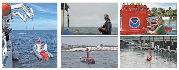
The Center additionally has been working to improve autonomous and uncrewed systems as they are poised to be important mapping platforms of the future.