Dust storms can be much more than just a minor annoyance for pilots flying through them. The tiny airborne dust particles can damage engines and threaten the safety of pilots and passengers. Spring is a peak season for dust storms in the Southwest U.S. The combination of lingering winter air in the north and slowly encroaching summer-like air masses from the Gulf of Mexico culminate into strong storm systems that often end with very strong winds behind the exiting cold front.
These winds can easily and quickly loft dust into the air in the arid climates of the American Southwest. Meteorologists at NOAA’s Aviation Weather Center closely monitor the potential for dust storms.
Aside from flight delays, diversions, and cancellations due to decreased visibility, dust can also cause serious mechanical problems that can lead to false flight speed readings, reduced engine performance and potential engine flame-out.
Ironically, the same dust storms that are impossible to overlook by pilots and air traffic controllers are extremely difficult to observe using legacy satellites. The legacy Geostationary Operational Environmental Satellites (GOES) were designed to view clouds through visible, infrared, and water vapor channels.
Neither the infrared nor water vapor channels are sensitive to the unique composition of dust particles, making them essentially invisible at those wavelengths. Dust is also difficult to detect with visible channels due to its similarity in color to the surrounding arid ground of the desert.
Fortunately, scientists and engineers have solved this problem with the Advanced Baseline Imager (ABI) satellite sensor aboard the new generation of NOAA’s GOES-R series of weather satellites.
The first ABI was launched onboard GOES-16 and became officially operational in December 2017. The ABI was designed with a higher spectral resolution, increasing the number of channels from 6 to 16 compared to the instruments on legacy satellites.
Not only do the extra channels broaden the scope of meteorological phenomena that can be detected, but meteorologists have discovered great utility in combining these channels into composite images called “Red-Green-Blue” composites (RGBs), which take advantage of multiple channels to help distinguish a specific feature, such as dust, from other clouds or surfaces.
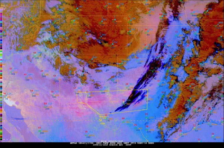
On April 13, 2018, Senior Aviation Meteorologist Pete Reynolds took advantage of the new GOES-16 Dust RGB imagery to monitor blowing dust in western Texas. Pete knew that high winds and lofted dust were expected across portions of New Mexico and Texas.
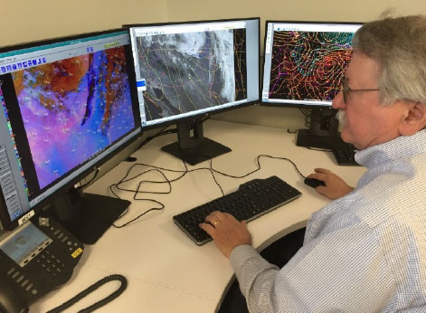
The RGB imagery clearly showed the first indications of dust, and Pete issued a SIGMET (Significant Meteorological Information, which is a weather advisory that contains meteorological information concerning the safety of aircraft) for blowing dust shortly thereafter. Within 20 minutes, there were three pilot reports of Instrument Flight Rules (IFR) due to low visibility within the SIGMET area.
Pete said the ability to clearly see the dust right at its onset served as a critical decision aid and resulted in extra lead time for a potentially impactful aviation hazard.
“This imagery worked to perfection today as I was able to get the jump on a blowing dust SIGMET over southern New Mexico and western Texas based on the darkening pink area," he said. "It also showed movement of the area which helped in determining what points to use for the SIGMET.”
The Dust RGB imagery was utilized throughout the rest of the event as well, particularly when the movement of the dust warranted a reissuance of the SIGMET further east. The RGB clearly showed the direction the lofted dust was moving and guided the points for the new SIGMET area.